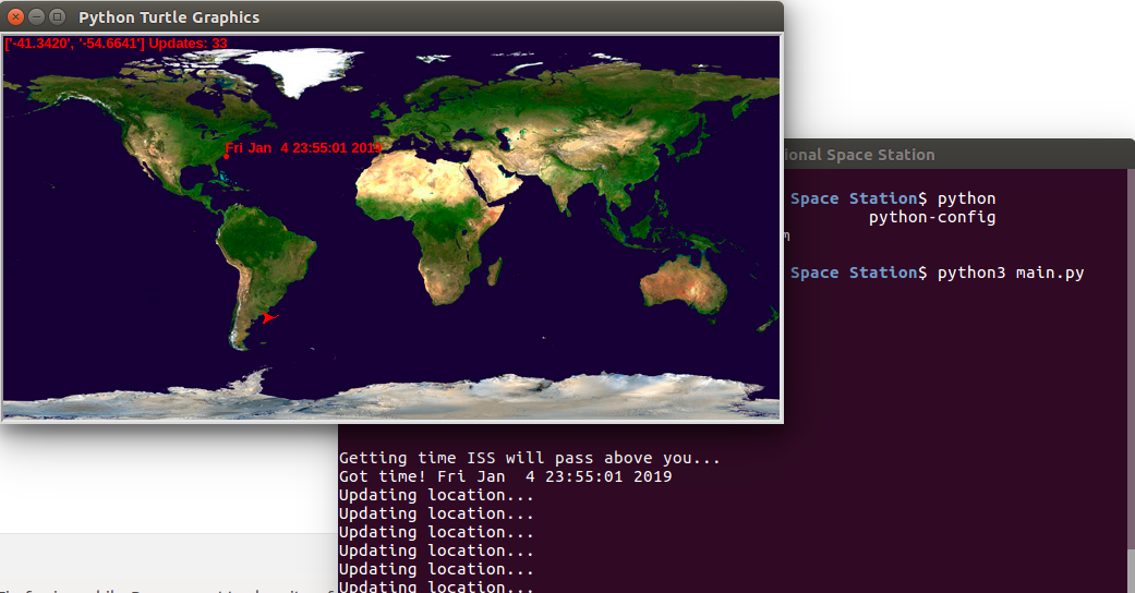
Fetches live coordinates from the International Space Station from an open source API, http://api.open-notify.org/iss-now.json. Reponse yields current latitude and longitude of ISS. Polls lat/longs on an interval and normalizes it to an image of earth.
The result is taking the 3d position of the ISS and plotting it against a 2D map of Earth, and as time progesses, the path of the ISS is visualized. Map depicts next time ISS will fly overhead my location in North Carolina
