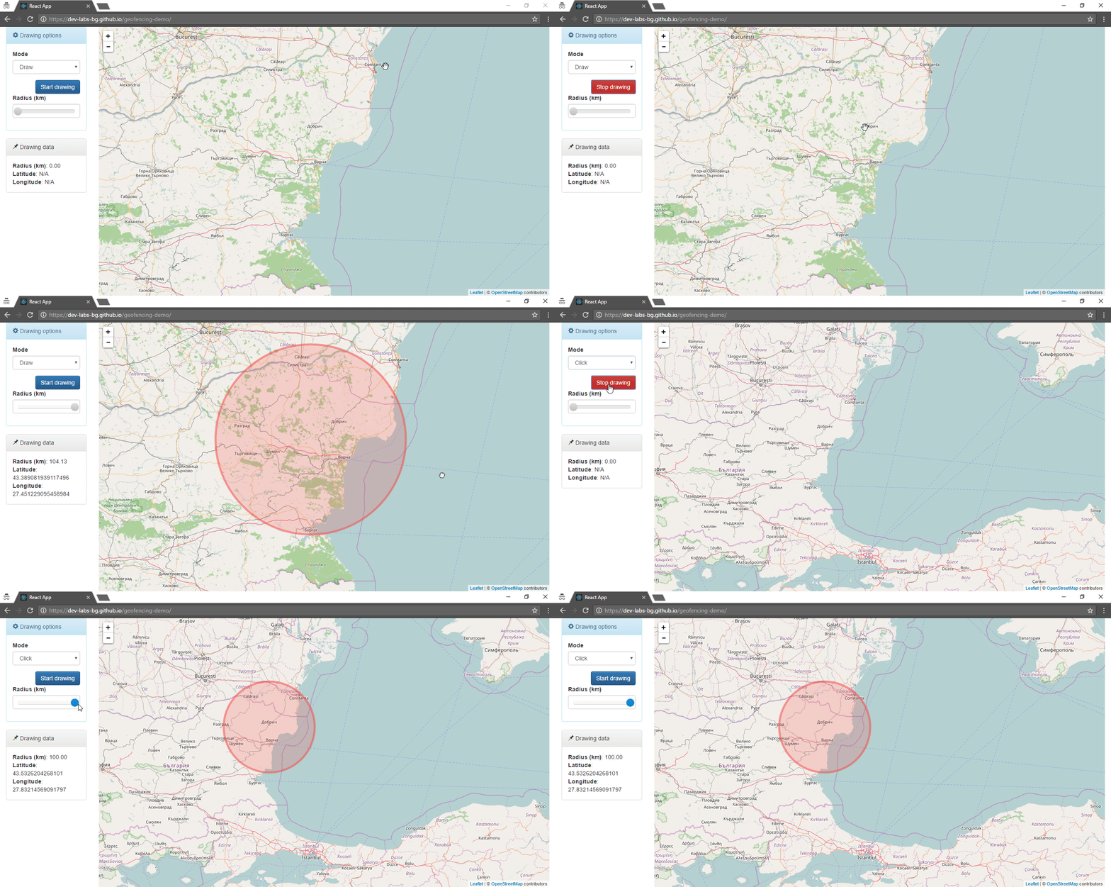
Geofencing example implemented on React and Leaflet.
It includes drawing on the map by two possible scenarios (drawing modes):
- Mouse dragging.
- Clicking on the map. Here it will create a Circle with predefined radius. Аfterwards you can change the radius with the slider component.
In the both modes you have Drawing data summary panel, where you can check the radius and the center of the already drawn Circle.
https://dev-labs-bg.github.io/geofencing-demo/
You’ll need to have Node >= 4 on your machine.
npm startFirstly I tried to accomplish the example with CircleMarker object.
Due to that I implemented custom components/Draw.js component, instead of using Leaflet.Draw library (the library implements the drawing with Circle, I need the CircleMarker object).
In the middle of example implementation I faced a few problems derived from the fact that CircleMarker works with pixels, instead of meters.
That leads to the following cases:
- Once the marker is drawn in pixels, then it doesn't scale correctly on map zoom level changing
- What we're doing if we want a radius of 10 km. We can convert pixels to km, but ...
So in the above cases we have to resolve/implement something, that is already done in Circle object. The both objects (Circle and CircleMarker) differ only in the metrics (meters vs pixels).
Therefore, I changed CircleMarker with Circle and kept my custom components/Draw.js component architecture and implement drawing functionality from the scratch.
Next time I'll implement a React component that wraps Leaflet.Draw or use an already implemented wrapper.
