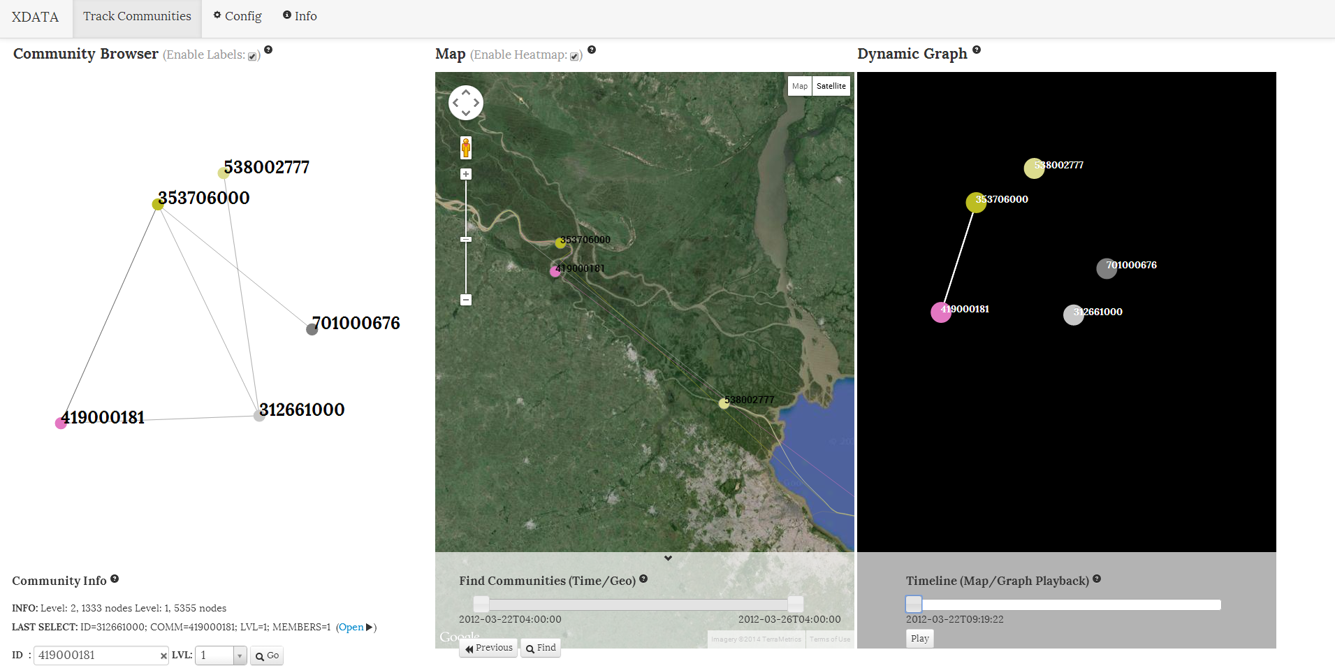
Providing data analysts a platform to explore communities of co-occurring tracks (or paths) of movement.
Aggregate your track information into communities of geospatial and temporal co-occurrence, visualize those tracks on a geographic map, and observe where and when inferred tracks of movement cross paths.
This tool is a synthesis of several analytic components and visualization techniques that allow a user to browse a network of communities, follow tracks of movement, and observe co-location highlights within a dynamic graph.
A collection of independent entries that represent an identified object's geographic location at a given point in time.
Key Data Fields [ ID, TIMESTAMP, LATITUDE, LONGITUDE ]
Specific formatting and analytic tool configurations for using your own data set(s) is provided within the wiki.
- Utilizes Aggregate Micro Paths to infer movement patterns based on given geo-temporal data and build tracks (or paths) of movement for each unique object in your collection.
- Determine spatial and temporal co-occurrence for your objects based off the inferred movement patterns.
- Produce a graph object where relationships are based off the (configurable) definition of geospatial and temporal co-occurrence.
- Scales the data with Distributed Louvain Modularity, building hierarchical levels of community that can be browsed and visualized as a series of expanding networks of community.
- Constructs dynamic graph data to help highlight specific tracks of movement and the co-occurrence events in a given geo-temporal frame.
- Provides a visualization tool that allows a user to browse aggregated networks of communities, follow tracks of movement on a map, and observe co-location highlights in the form of a dynamic graph.
In order to utilize your own data sets, some knowledge of the following aspects will be required:
Get Track Communities up and running with example data quickly and easily! Read how at the wiki.
